Karst and Tectonic landform heritages in Non nuoc Cao Bang UNESCO global geopark
- Tuesday - 09/04/2019 14:30
- Close page
Karst and tectonic landforms reflecting the karst evolution in the West of Cao Bang Tien Yen deep seated fault (Nguyen Binh and Thach An districts)
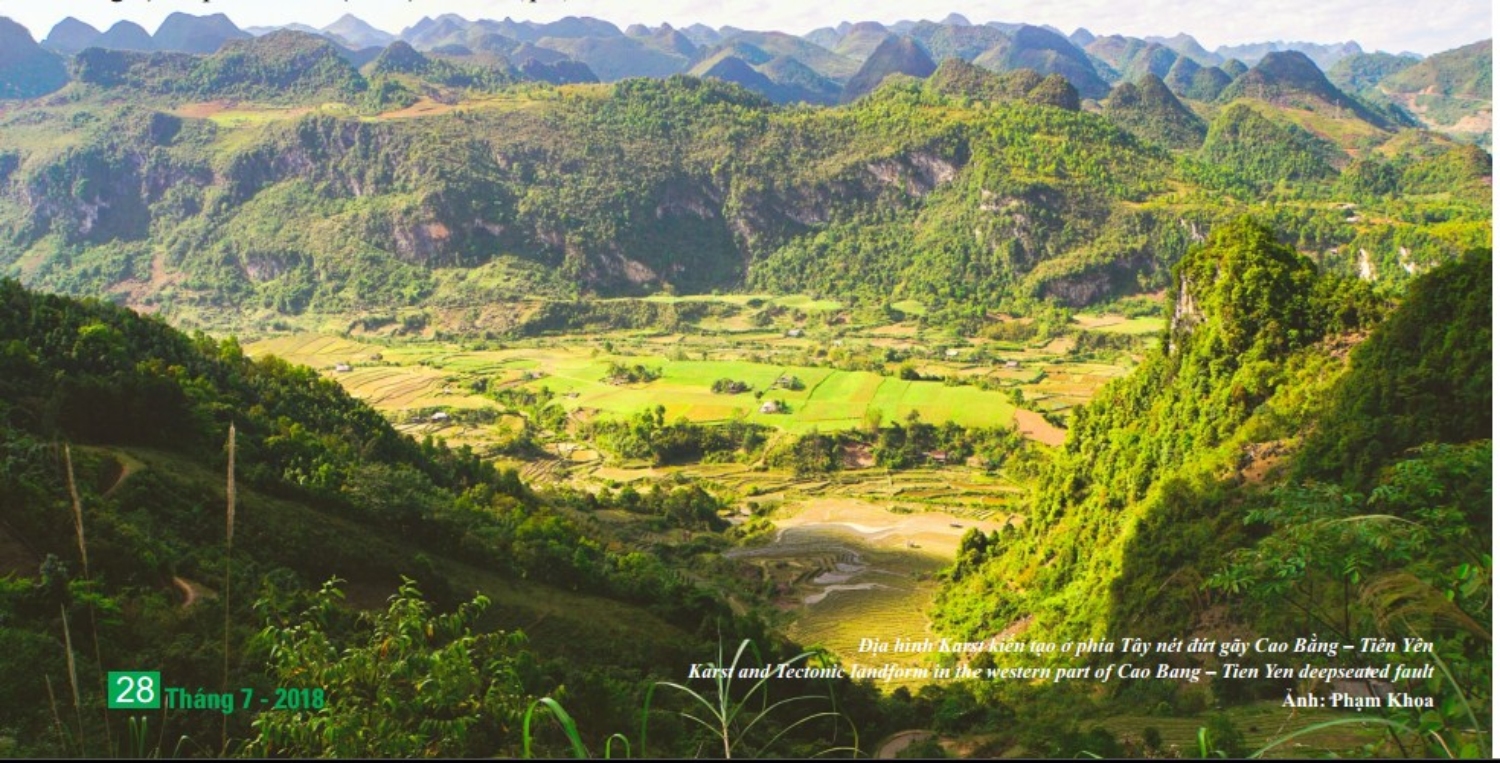
The western area of Cao Bang-Tien Yen fault, except for the Cao Bang basin, covers most of Nguyen Binh and Thach An districts. This area exhibits a mix of karst landforms and other denudation-erosion landforms on terrigenous rocks of the Song Hien formation and granites of the Phja Oac complex. The karst landforms are part of the Dong Mu karst massif 1,100-1,300m asl. It forms a plateau between the Nang River and Bang Giang River and has been termed “Binh Lang plateau” by Bourett (1922). On the relatively flat plateau surface, the terrain is weakly intersected into mountain ranges extending mostly in a NW-SE direction separating wide, flat-bottomed inter-connected valleys. The area to the west of Cao Bang-Tien Yen fault has been identified as part of over thrust napes “napes préyunnanaises” (J. Deprat, 1915, 1917; Lepvrier et al., 2011).
At the edge of the massif, the land surface has slipped down to 700-1,000m, much lower than the ancient planation surface. This has favored rapid karst evolution creating sharp pyramid-like towers separated widely by flat or undulating valley floors. Hogback topography is also conspicuous with cliffs facing east with piles of rock collapse at their foot, creating stepped erosion terraces of Nguyen Binh River and the so-called “self-covered” karst.
In addition to the karst plateau west of the Cao Bang-Tien Yen fault, from Nguyen Binh district towards Thach An district there are large areas of non-karst rocks of the Song Hien terrigenous Formation (T1sh) and the Pia Oac granitic complex (Kpo), forming highly dissected structures.
Along Provincial Route No.34 from Nguyen Binh to Cao Bang city, the mountain ranges are more than 1000m high, while to the west and east of Cao Bang city they are only 400-600m and 250-350m high, respectively. These mountain ranges clearly demonstrate topographical steps which are remnants of planation surfaces at altitudes of 400-600m, 700-1000m and 1100-1300m.
In addition to the karst plateau west of the Cao Bang-Tien Yen fault, from Nguyen Binh district towards Thach An district there are large areas of non-karst rocks of the Song Hien terrigenous Formation (T1sh) and the Pia Oac granitic complex (Kpo), forming highly dissected structures.
Along Provincial Route No.34 from Nguyen Binh to Cao Bang city, the mountain ranges are more than 1000m high, while to the west and east of Cao Bang city they are only 400-600m and 250-350m high, respectively. These mountain ranges clearly demonstrate topographical steps which are remnants of planation surfaces at altitudes
Karst and tectonic landforms reflecting the karst evolution cycle in the the east of Cao Bang – Tien Yen deep seated fault (part of Ha Quang, Tra Linh and Hoa An district)
The northern area of Cao Bang Geopark, mainly of Ha Quang district and part of Hoa An and Tra Linh districts, is of Luc Khu massif, another famous karst massif of Northeast Vietnam. The massif’s height descends from 1000m in the northwest to 700m in the southeast, gradually leaning toward a very large karst area east of Ma Phuc pass - the so-called Quang Hoa karst plateau. It is also a karst plateau but compared to the Dong Mu karst plateau, the karst evolution here is in the older phase.
The karst evolution intensifies from northwest to southeast. In the northwest, the main karst landforms are ranges, peak-cluster depressions with cones that surround closed valleys where the vertical erosion process still prevails. Rain water quickly disappears to underground, so surface water is rather scarce while groundwater is plentiful. To the southeast is the mature and old karst landforms with karst towers, pyramids and cones which have been or nearly separated, surrounding wide valleys; their bottom is quite flat and close to the local erosion level. At this point, the Tra Linh River connects these valleys to form the Thang Hen “turlough” lake system - a unique scenic spot of Cao Bang Geopark.
The southern end of the the Luc Khu massif is in Lung Tha (Quang Trung) is mostly characterized by karst plateau features. Its cliff faces the Southwest, Northeast, and East; located on the denudation-erosion terrigenous rock base. The peak surface, about 700-1000m exists the young karst terrains, including the peak-cluster depressions range with cones running through the Northeast-Southwest along the Northwestern edge, moving toward the Southeastern parallel. These ranges surround the long, closed and aslope-bottom valley. The east of Nguyen Hue commune, moved left along the Southeast parallel fault, exposes the bottom of the terrigenous rocks with some remnants of karst massifs on the old careen fiel.