Thang Hen complex and the interesting “tourlough” phenomenon
Located in Tra Linh district and belonged to the Eastern route of Non nuoc Cao Bang UGGp, Thang Hen lake system posses important and interesting geological values of international significances with astonishing landcapes. It can be regarded as must-see site for visitors. Thang Hen lake was recognized as a national scenic spot according to Decision No. 53/2001/QD-BVHTTDL of December 28th 2001 of the Ministry of Culture, Sports and Tourism (MOCST). However, it is essential to mention the lake-caves-underground rivers system in this area.
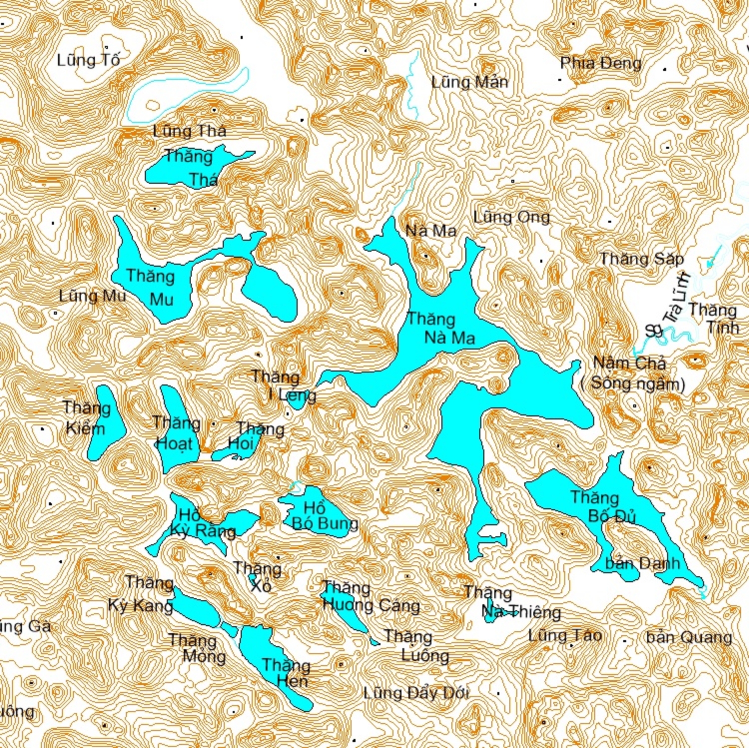
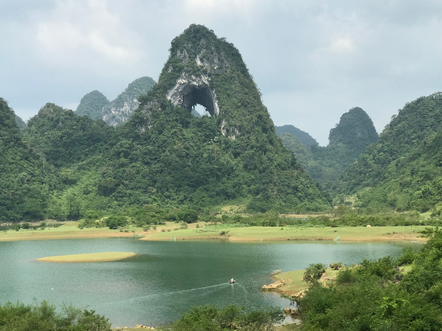
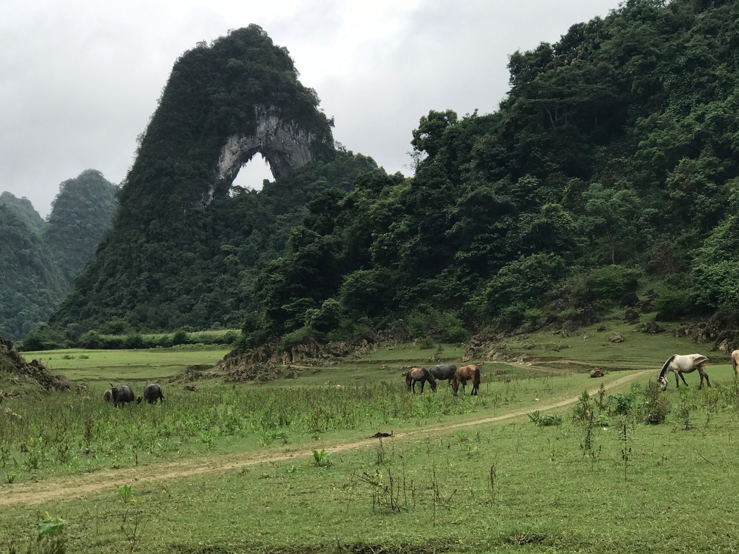
Thang Hen lake system has 36 natural lakes, each of which is a few dozens to several hundred meters away from each other. All the lakes are located in the large valley bordered by Quoc Toan Commune (Tra Linh District) and Ngu Lao Commune (Hoa An District). The lakes were named in local language, such as Thang Vat, Na Ma, Thang Loong, Thang Hoi etc. from hundreds of years ago. Thang Hen is the largest lake with length of nearly 2,000m, width of 500m and depth of 40m, surrounding by old forests and karren landforms alternating with rugged cliffs. In local language, Thang Hen means “bee-tail”, because from the birdview the lake looks like a giant bee’s tail.
The system of Thang Hen Lake and underground river caves was formed and developed in limestones of the Bac Son Formation (C-Pbs), at the intesections of fault systems striking in the northwest-southeast, northeast-southwest, sub-meridian and sub-parallel directions. The lakes are located on the valley floor surrounded by peaks that are connected with each other by low saddles, forming the typical karst peak cluster-depression terrain. The peaks, at quite similar altitudes, are remnants of a planation surface at an altitude of about 650m, while the valley floors are at altitudes of 550-600m. The waterlines show that lake water levels fluctuate within about 20m around 600m. Some fossil cave floors are found at altitudes of 600-650m, while active caves are at lower altitudes. According to the suvey results in 2012 by the French-Vietnamese speleologists, the underground cave section that is connected with Thang Hen Lake develops to 820m in length in sub-meridian and sub-parallel directions and down to the depth of 54m under the recent surface.
The karst hydrologic characteristics in Thang Hen lake system are very special in which Thang Hen Lake plays an important role. Observations show that there are two high tides a day in Thang Hen Lake. In the dry season, while most other lakes are dried out, water still remains in Thang Hen Lake. In rainy season, while the water in other lakes is dull red, that in Thang Hen Lake is still clean and pure.
Survey results of karst hydrologic characteristics in Thang Hen Lake System show:
- All the lakes have at least one sinkhole to collect water, which makes them unable to retain surface water. The surface water, as a result, disappears into the underground system.
- In some lakes such as Thang Bo Sung and Thang Bo De, these sinkholes play as discharge gate as well as “swallow holes”.
- There are 3 discharge scenarios in Thang Hen Lake System:
+ In dry season, the water level decreases to below 600m asl. Thang Hen Lake is the largest and the deepest lake among the lakes in the northeast part of the system (the Thanh Tinh, Thang Nam Cha, Thang Na Thieng lakes etc. are connected with each other and flow into Thang Hen via the sinkholes and underground cave system, making them exhausted). The water in Thang Hen Lake is connected with underground river and fluctuates by surface/ground water in the south-southwest.
+ Most of the time in rainy season, the water level is about 600-610m asl. A large amount of water runs into Thang Hen Lake, while the discharge capability is low. In this situation, Thang Mong plays the role of a main outlet. Water from other lakes flows into Thang Hen and Thang Ky Kang, then discharges farther through Thang Mong.
+ When flood water is over 610m asl, and outlets in Thang Hen and Thang Mong cannot discharge water, it once again flows back to Thang Hen Lake, but this time the outlet may be another cave located at a higher altitude than that at the bottom of Thang Hen Lake.
Visitors to Thang Hen lake system might learn more about other interesting geologies in this area such as fossils (crinoids and fusulinids) in limestones, and facet and evidents of the Cao Bang –Tien Yen deep seated fault. The primative landscapes are evidents of ecological preservation. Thang Hen Lake System is among the treasures of the Cao Bang Geopark and of international significance for its education, sciencetific research, and landscapes.
Reader Comments
You must login to comment this article
Newer articles
Older articles
- Address: No 083 Vuon Cam St, Hop Giang District, Cao Bang City
- Phone: +84-2063.754.555
- Fax: +84-4-35500914
- Email: caobanggeoparkvietnam@gmail.com
- Website: http://caobanggeopark.com
- Online27
- Today295
- This month9,364
- Total11,116,031