CAO BANG RETAINED THE UNESCO GLOBAL GEOPARK LABEL AFTER ITS FIRST REVALIDATION, 18 NEW UNESCO GLOBAL GEOPARKS WERE NAMED


According to its guideline, UNESCO Global Geoparks are given this designation for a period of four years after which the functioning and quality of each UNESCO Global Geopark is thoroughly re-examined during a revalidation process. Non nuoc Cao Bang was certified as a UNESCO Global Geoparks in 2018. Following the evaluation and revalidation schedule, Non nuoc Cao Bang Geopark would undergo its first revalidation in 2021. However, due to the impact of Covid-19 pandemic, in the years of 2020 and 2021, many evaluation and revalidation missions were postponed, largely in Asia, including Viet Nam. Therefore, Non nuoc Cao Bang received the delegation of UNESCO Global Geoparks evaluators in August, 2022. Following the itinerary, the evaluators conducted a field survey to 38 geosites and geopark partners’ establishments on 3 tourism routes of Non nuoc Cao Bang UNESCO Global Geopark. After field mission, the UNESCO evaluators highly appreciated the efforts of Cao Bang for the development of the Geopark, and affirmed that Non nuoc Cao Bang Geopark has been performing good practices, for example, the “Geopark ambassador club” as tool for geo-education in schools and geo-product development.

The field report on Non nuoc Cao Bang Geopark was examined at the second session of the UNESCO Global Geoparks Council’s 7th meeting held virtually on 7 – 9 December 2022. As a result of this comprehensive evaluation, Non Nuoc Cao Bang UNESCO Global Geopark has been awarded a "green card" for a further four-year period (01/01/2022 – 31/12/2025) with 6 recommendations: (1) Improve geological heritage, conservation and promotion; (2) Improve visibility; (3) Education and capacity building; (4) Management body, increasing the participation of local population in geosites management; (5) Engage new measures to protect and promote still existing local and ethnic languages; (6) Networking.
Recently, UNESCO’s Executive Board has endorsed the addition of 18 sites to the UNESCO Global Geoparks network. This brings the total number of geoparks to 195 in 48 countries. Two UNESCO Member States join the network: New Zealand and the Philippines. The new GGN members includes:
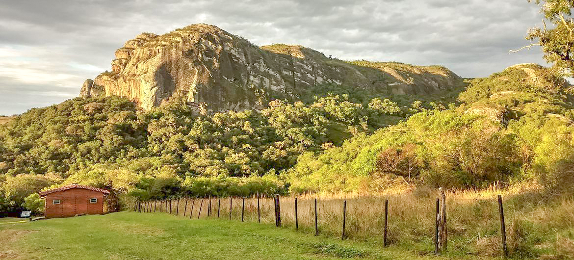
Brazil: Caçapava UNESCO Global Geopark: The geopark is located in Rio Grande do Sul State in southernmost Brazil. Its geological heritage, which consists of mining sulfide metals and marble, has been vital for the region’s economic development. It represents the most complete and well-exposed record of the transition of the South American Platform from the Ediacaran period to the Cambrian period between 600 and 500 million years ago.
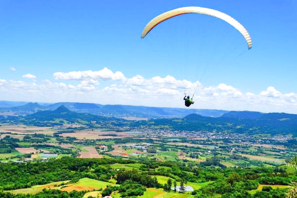
Brazil: Quarta Colônia UNESCO Global Geopark:
This geopark is located in the south of Brazil between the Pampa and Atlantic Forest biomes. There are colonial villas and traces of indigenous settlements of the quilombolas (Afro-descendants)which date back hundreds of years. The geopark is also rich in fossils of animal and plant life dated to 230 million years ago.
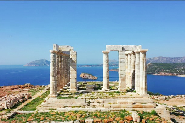
Greece: Lavreotiki UNESCO Global Geopark: Famous for the abundance and variety of its mineralogical specimens, many of which were first discovered in the area.
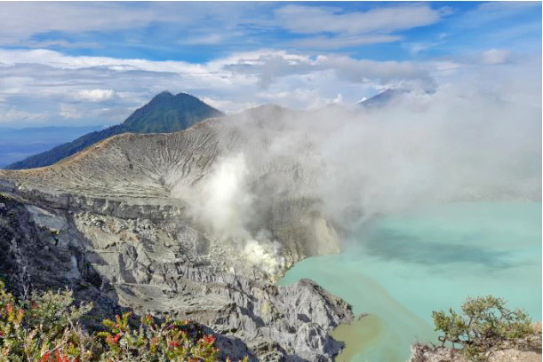
Indonesia: Ijen UNESCO Global Geopark:
This geopark is located in the Banyuwangi and Bondowoso Regencies in East Java Province. Ijen is one of the most active volcanoes in the Ijen caldera system. Ijen is the most acidic crater lake on Earth and the largest of its kind.
Indonesia: Maros Pangkep UNESCO Global Geopark:
This geopark is located along the southern arm of the island of Sulawesi in the Maros and Pangkep Regencies. Although the geopark covers an area of 5,077 km2, more than half (55.4%) of it lies underwater. The geopark area contains a cluster of 39 islands. This archipelago lies in the Coral Triangle and serves as a centre for the conservation of coral reef ecosystems.
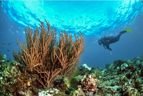
Indonesia: Merangin Jambi UNESCO Global Geopark:
This geopark is home to the unique fossils of “Jambi flora”, which are the only exposed fossilized plants of their kind in the world today. The landscape of this geopark combines lowlands on the east side with highlands on the west side.
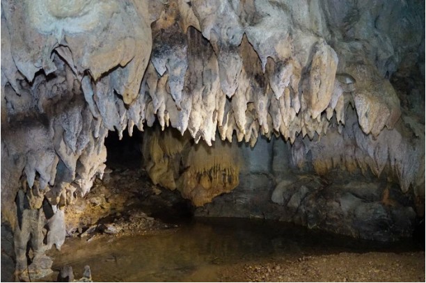
Indonesia: Raja Ampat UNESCO Global Geopark:
This geopark’s territory includes four main islands and is special for having the oldest exposed rock unit in the country (Silurian–Devonian dating back 443.8–358.9 million years ago). The most unusual geological feature are the Tropical Islands which emerged as a consequence of sea-level rise in the Quaternary Period (between 2.58 million years ago and 11,700 years ago); here, karstification has created numerous caves both above and below the water line.
Iran: Aras UNESCO Global Geopark:
This geopark located in northwestern Iran at the southern end of the Lesser Caucasus mountain range. The most important geological feature of international significance in this geopark are the traces of the extinction event that occurred 252 million years ago which marks the Permian–Triassic Boundary, one of the most important events in the Earth's history.
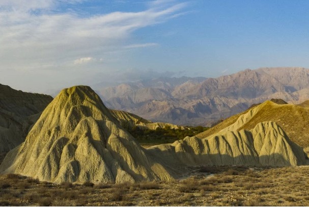
Iran: Tabas UNESCO Global Geopark:
The 22,771 km2 of desert in northwest South Khorasan Province where this geopark is located as ‘the geological paradise of Iran’. This is due to the fact that one can follow the evolution of the planet from the earliest part of the Earth’s history 4.6 billion years ago (the Precambrian) to the Early Cretaceous about 145 million years ago without the slightest interruption.
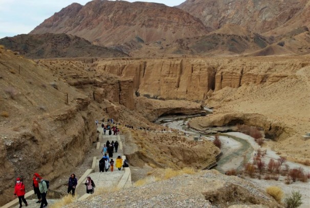
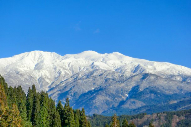
Japan: Hakusan Tedorigawa UNESCO Global Geopark:
Located in central Japan, where it follows the Tedori River from Mount Hakusan down to the sea, the Hakusan Tedorigawa Geopark records approximately 300 million years of history. It contains rocks that were formed by the collision of continents. It also has strata containing fossils of dinosaurs which accumulated in rivers and lakes on land at a time when Japan was attached to the Eurasian continent
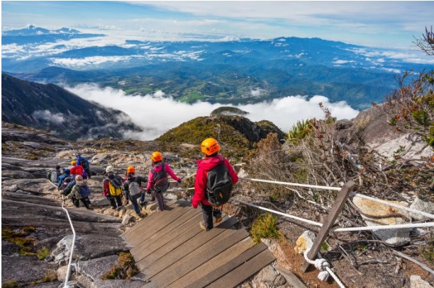
Malaysia: Kinabalu UNESCO Global Geopark
Covering an area of 4,750 km2, the Geopark features incredible geodiversity, including ultramafic rocks which are billions of years old, and is home to many endemic plants and animals not found anywhere else on Earth.
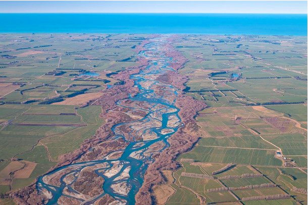
New Zealand: Waitaki Whitestone UNESCO Global Geopark:
New Zealand’s first UNESCO Global Geopark lies on the east coast of the South Island, extending over an area of 7,214 km2 from the Waitaki Valley to the base of the Southern Alps. The geopark offers exceptional insights into the history of the Earth’s eighth continent, Zealandia. Today, about 94% of Zealandia remains submerged, stretching from east of New Zealand all the way north to New Caledonia.
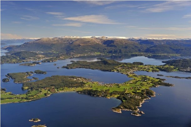
Norway: Sunnhordland UNESCO Global Geopark:
The landscapes in this geopark range from glacier-covered alpine mountains to archipelagos with thousands of islands situated on the strandflat along the coast. Two of the largest orogenic belts on Earth meet in the geopark.
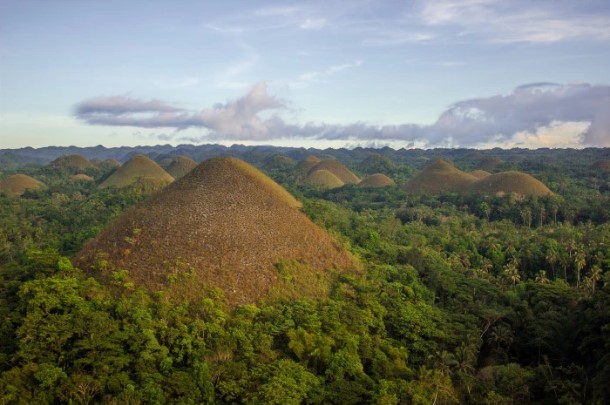
Philippines: Bohol Island UNESCO Global Geopark:
The Philippines’ first UNESCO Global Geopark, Bohol Island. The geopark abounds in karstic geosites such as caves, sinkholes and cone karst, including the famous cone-shaped Chocolate Hills in the centre of the geopark. The Danajon Double Barrier Reef along the northern coast is the only one of its kind in Southeast Asia
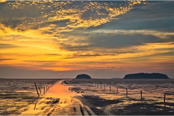
Republic of Korea: Jeonbuk West Coast UNESCO Global Geopark:
This geopark tells 2.5 billion years of well-exposed geological history in the western part of the country. Jeonbuk West Coast UNESCO Global Geopark has already been recognized by UNESCO as a natural and cultural World Heritage property and as a biosphere reserve and designated a Ramsar site for its exceptional wetlands.
Spain: Cabo Ortegal UNESCO Global Geopark:
This geopark provides some of the most complete evidence in Europe of the collision that caused Pangea, a process known as the Variscan Orogeny. Most of the rocks in this geopark were brought to the surface by the collision of two continents, Laurussia and Gondwana, which would eventually join the supercontinent Pangaea about 350 million years ago.
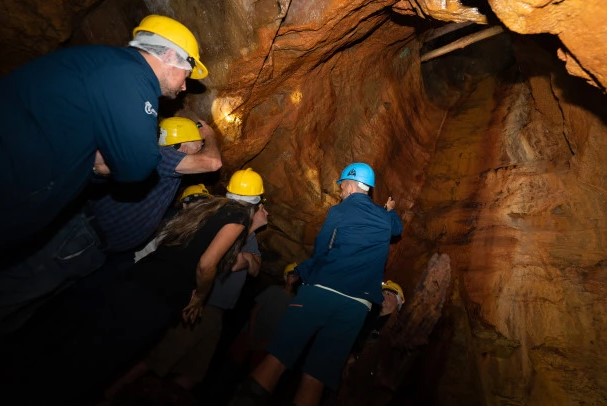
Thailand: Khorat UNESCO Global Geopark:
This geopark is located in Nakhon Ratchasima Province in northeast Thailand. The unique geological feature of the region is the diversity and abundance of fossils ranging in age from 16 million to 10 000 years including dinosaur and elephant fossils.
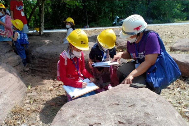
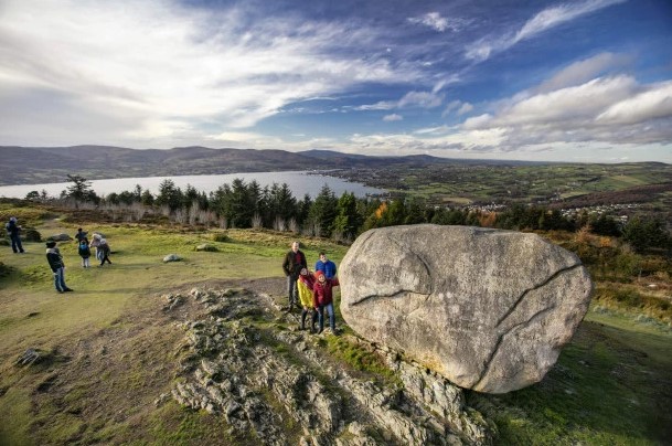
United Kingdom of Great Britain and Northern Ireland: Mourne Gullion Strangford UNESCO Global Geopark:
The Geopark covers an area of 1,932 km2. It charts the closure of the Iapetus Ocean and the birth of the North Atlantic Ocean. The combination of mountain and coastal environments has led to the development of a hugely diverse range of glacial features not commonly seen in such a small area.
Reader Comments
Newer articles
Older articles


